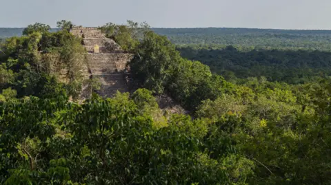
Scientists have recently uncovered a long-lost Mayan city, hidden for centuries within the dense jungles of Mexico, utilizing an innovative remote sensing technology known as LiDAR.
What is LiDAR?
LiDAR stands for Light Detection and Ranging. This technology employs light in the form of pulsed laser beams to measure distances between a sensor, typically mounted on an aircraft, and the Earth’s surface. According to the US Geological Survey, LiDAR data enables the creation of high-resolution 3-D models of ground elevation with vertical accuracy up to 10 cm.
Components of LiDAR Technology
LiDAR instrumentation consists of:
- Laser: Emits rapid laser pulses.
- Scanner: Collects data on the returning light.
- GPS Receiver: Provides precise location data.
The laser beams travel towards the ground, bouncing off various surfaces, including vegetation and buildings. The reflected light is then recorded by the LiDAR sensor.
How LiDAR Works
The system calculates the two-way travel time of light pulses to determine the distance between the terrain and the sensor. It processes this information alongside data from GPS and Inertial Measurement Systems (IMS) to create an elevation map of the Earth.
Initially, LiDAR data is collected as a “point cloud,” which consists of numerous individual points reflected from all surface features. The intensity of the reflected light allows scientists to differentiate between various features such as vegetation and buildings. Even dense tree canopies permit some light to penetrate and reach the ground.
Further refinement of the LiDAR data leads to the development of a “bare earth” Digital Elevation Model, where structures and vegetation are removed, allowing for clearer insights into the terrain.
Applications of LiDAR
LiDAR is instrumental in generating precise, three-dimensional information about the Earth’s shape and surface characteristics. This information is beneficial for:
- Geographers
- Policy Makers
- Conservationists
- Engineers
Recently, LiDAR has emerged as a valuable tool for archaeological discovery, enabling researchers to survey vast areas of land quickly.
The Discovery of the Lost Mayan City
Luke Auld-Thomas, the lead researcher, stated, “For the longest time, our sample of the Maya civilization was a couple of hundred square kilometers total.” Previously, archaeologists spent considerable effort meticulously walking over every square meter of land, often using machetes to clear vegetation to identify remnants of ancient structures.
With LiDAR, researchers can efficiently analyze larger land areas from the comfort of their homes or laboratories. Auld-Thomas utilized publicly available LiDAR data collected in 2013 for a forest monitoring project to identify the city he named Valeriana in the Campeche region of Mexico.
Features of Valeriana
The city exhibits characteristics typical of a Classic Maya political capital, including:
- Multiple enclosed plazas connected by a broad causeway
- Temple pyramids
- A ball court
- A reservoir created by damming a seasonal watercourse
- An architectural layout suggesting a founding date before 150 CE
Future Discoveries
Auld-Thomas expressed hope that this unexpected discovery could lead to the unearthing of additional hidden settlements of the Maya civilization. He remarked, “We found a large city with pyramids right next to the area’s only highway, near a town where people have been actively farming among the ruins for years. The government never knew about it, the scientific community never knew about it… there’s a lot more to be discovered.”
Multiple Choice Questions (MCQs):
- What does LiDAR stand for?
- A) Light Detection and Ranging
- B) Laser Interference and Data Retrieval
- C) Light Information and Distance Analysis
- D) Laser Detection and Ranging
- Answer: A) Light Detection and Ranging
- Which of the following is NOT a component of LiDAR technology?
- A) Laser
- B) Scanner
- C) GPS Receiver
- D) Thermometer
- Answer: D) Thermometer
- What type of model is produced by refining LiDAR data to strip away structures and vegetation?
- A) Digital Terrain Model
- B) Bare Earth Digital Elevation Model
- C) 3D Topographical Model
- D) Geospatial Information Model
- Answer: B) Bare Earth Digital Elevation Model
- What significant archaeological finding did Luke Auld-Thomas identify using LiDAR?
- A) An ancient trade route
- B) A lost Mayan city named Valeriana
- C) A burial site
- D) A Mayan ball game court
- Answer: B) A lost Mayan city named Valeriana
- What does Auld-Thomas hope to achieve with his discovery of Valeriana?
- A) To establish a tourist attraction
- B) To uncover further hidden settlements of the Maya civilization
- C) To replicate the archaeological findings elsewhere
- D) To secure government funding for excavation
- Answer: B) To uncover further hidden settlements of the Maya civilization
