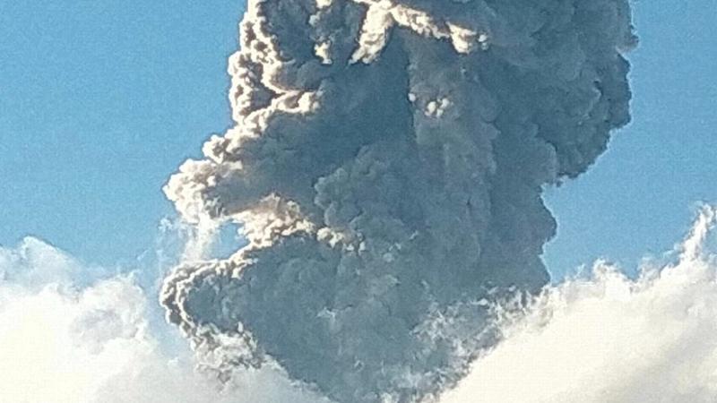
On Sunday, one of Indonesia’s most active volcanoes, Mount Marapi, erupted in Agam district of West Sumatra. The eruption sent thick columns of ash soaring into the sky, with ash clouds spreading for miles and blanketing nearby villages with volcanic debris. Despite the intensity of the eruption, no casualties were reported.
Characteristics of Mount Marapi’s Eruptions
Mount Marapi is notorious for its unpredictable eruptions. Unlike other volcanoes where tremors caused by deep magma movements can be detected by seismic monitors, Marapi’s eruptions are sudden and difficult to forecast. This unpredictability adds to the danger of the volcano’s eruptions.
The eruption released hot ash clouds that extended several miles from the crater. The ash columns reached as high as 2,000 meters (6,560 feet). Villages and towns near the volcano were covered with a thick layer of volcanic residue, which posed a significant threat to local residents.
Volcanic Alert Levels and Precautions
The nearly 2,900-meter (9,480-foot) tall volcano has been on the second-highest of four alert levels since January, due to the potential risks posed by its activity. As a result, climbers and villagers within a 3-kilometer (1.8-mile) radius from the crater have been prohibited from entering the area. This restriction is in place to protect people from potential lava flows.
Previous Incidents and Lessons Learned
Mount Marapi has a history of deadly eruptions. In December 2023, a sudden eruption resulted in the tragic deaths of 24 climbers and injuries to several others. Following this eruption, two climbing routes were closed for safety reasons.
Additionally, five months prior, heavy monsoon rains triggered a landslide of cold lava and mud, causing rivers to overflow and flood mountainside villages. The resulting deluge swept away people and homes, claiming 67 lives. The local community continues to deal with the emotional and physical aftermath of these events.
Impact of Volcanic Activity on Villagers
Local residents are still haunted by the flash floods and cold lava flows from the previous monsoon season. With the rainy season approaching, the risk of further natural disasters remains high. However, villagers have learned vital lessons about the dangers of eruptions and how to protect themselves in case of future volcanic activity.
Indonesia’s Volcanic Activity
Indonesia, home to approximately 282 million people, is situated along the “Ring of Fire,” a series of seismic fault lines encircling the Pacific Ocean. This geographical positioning makes the country particularly prone to earthquakes and volcanic eruptions, contributing to its ongoing challenges with natural disasters.
Multiple-Choice Questions (MCQs):
- What was the primary cause of concern during Mount Marapi’s eruption?
- a) Tsunami
- b) Ash clouds and volcanic debris
- c) Earthquakes
- d) Lava flow
- Answer: b) Ash clouds and volcanic debris
- How high did the ash columns from Mount Marapi’s eruption reach?
- a) 1,000 meters
- b) 2,000 meters
- c) 3,000 meters
- d) 5,000 meters
- Answer: b) 2,000 meters
- What is the current alert level of Mount Marapi as of the eruption on Sunday?
- a) Highest
- b) Second highest
- c) Lowest
- d) Third highest
- Answer: b) Second highest
- What happened during the previous eruption of Mount Marapi in December 2023?
- a) 24 climbers were killed
- b) A volcanic earthquake occurred
- c) The volcano became dormant
- d) No casualties were reported
- Answer: a) 24 climbers were killed
- What was one of the effects of the monsoon rains prior to the eruption?
- a) Eruption of a new volcano
- b) Flash floods and cold lava flows
- c) Increased volcanic activity
- d) Formation of new rivers
- Answer: b) Flash floods and cold lava flows
- Which region of Indonesia is Mount Marapi located in?
- a) Central Java
- b) East Nusa Tenggara
- c) West Sumatra
- d) Bali
- Answer: c) West Sumatra
