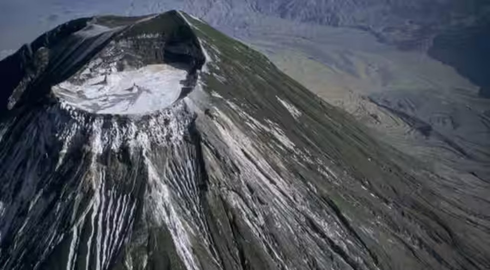
Ol Doinyo Lengai, a volcano located in Tanzania, is known for its unusual volcanic activity. Over the past decade, this volcano has been continuously erupting carbonatite lava while simultaneously sinking into the ground. Recent studies reveal that this phenomenon involves the volcano subsiding at a rate of 1.4 inches per year.
Volcanic Eruption and Sinking
- Eruption Characteristics: Ol Doinyo Lengai is unique for its eruptions of carbonatite magma, which is extremely runny and saturated with alkali elements like calcium and sodium, but low in silica.
- Sinking Rate: According to recent research, the ground near the volcano’s summit has been sinking at a rate of 1.4 inches (3.6 cm) annually between 2013 and 2023.
Study Findings
- Volcanic Shrinkage: Over the study period, the 9,718-foot-tall (2,962 meters) volcano has shrunk by approximately 1.2 feet (36 cm).
- Research Methods: Data from Sentinel-1 and Cosmo-SkyMed satellites were used to create maps showing ground changes around Ol Doinyo Lengai. These maps indicated a steady rate of displacement in a circular patch around the northern crater.
- Cause of Sinking: Scientists attribute the sinking to the deflating magma reservoir beneath the volcano, which is located about 3,300 feet (1,000 meters) below the surface.
Unique Features
- Magma Properties: The carbonatite lava from Ol Doinyo Lengai is described as some of the strangest in the world, producing unique “garden hose” eruptions and leaving behind white stains.
- Expert Opinion: Volcanologist Erik Klemetti described Ol Doinyo Lengai as one of the most unique volcanoes on Earth due to its distinct eruptive behavior and magma composition.
Historical Context and Future Research
- Previous Studies: Earlier research suggested that the new crater might be subsiding, but the latest study indicates that the upper slopes of the crater have also been sinking since 2013.
- Future Research Needs: The study highlights that the precise geometry and characteristics of the shallow magma plumbing system remain unclear. There may be a connection between the shallow reservoir and a larger magma storage area located deeper beneath the volcano.
Multiple Choice Questions (MCQs):
- What type of magma does Ol Doinyo Lengai erupt?
- A) Silicic magma
- B) Basaltic magma
- C) Carbonatite magma
- D) Andesitic magma
- At what rate has the ground near the summit of Ol Doinyo Lengai been sinking annually?
- A) 0.5 inches
- B) 1.4 inches
- C) 2.0 inches
- D) 3.0 inches
- What is the approximate height of Ol Doinyo Lengai?
- A) 7,500 feet
- B) 8,500 feet
- C) 9,718 feet
- D) 10,000 feet
- Which satellite systems were used to monitor changes around Ol Doinyo Lengai?
- A) Landsat-8 and TerraSAR-X
- B) Sentinel-1 and Cosmo-SkyMed
- C) GPS and MODIS
- D) Aqua and TDRS
- What is believed to be the cause of the sinking of Ol Doinyo Lengai?
- A) Increased volcanic activity
- B) Erosion of the summit
- C) Deflating magma reservoir
- D) Earthquake activity
